Learn about the Erie County Agricultural District Program and review common misconceptions about the program.
New York State Agriculture and Markets Law authorizes the creation of local agricultural districts pursuant to landowner initiative, preliminary county review, state certification, and county adoption. Agricultural districts encourage the continued use of farmland for agricultural production based on a combination of landowner incentives and protections, all of which are designed to forestall the conversion of farmland to non-agricultural uses.
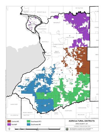
The Department of Environment and Planning manages all aspects of district creation, review and recertification, working closely with the County Agricultural and Farmland Protection Board and the County Legislature. Erie County’s four agricultural districts cover over 200,000 acres or about 30% of the County’s land area. You can also use Erie County’s Online Mapping System or the Agricultural and Farmland Protection Inventory to view agricultural districts by parcel.