Department of Public Works - Division of Highways Aerial Photographs (1920s and 1951)
- These series consist of a large number of scanned photos covering the entirety of Erie County with overlapping between adjacent photos. Visitors can use the static reference maps to identify areas of interest.
New York State Interactive Mapping Gateway
- Orthoimagery from the New York Statewide Digital Orthoimagery Program (NYSDOP), and the USGS National Aerial Photography Program (NAPP), which covered New York between 1994 and 1999, is available through this site. Orthoimagery is presented by year flown. As a default, the most recent NYSDOP imagery is displayed. Users can turn layers off and on to see different vintages of imagery. More information on the programs creating the imagery can be obtained from the orthoimagery pages on the NYS GIS Clearinghouse site.
Erie County Historical Markers and Aerial Photo Comparison Application
- Erie County Office of GIS hosts this site which displays the same aerial photo layers as in the NYS Gateway but also contains a Swipe Tool for easy comparison between aerial years. Also present on the map are the locations of Historical Markers throughout the County. This Marker Database is maintained by HMdb.org.
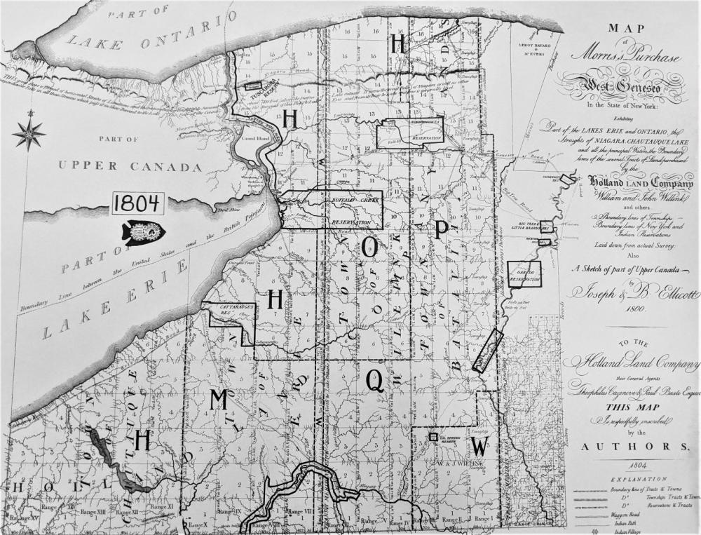
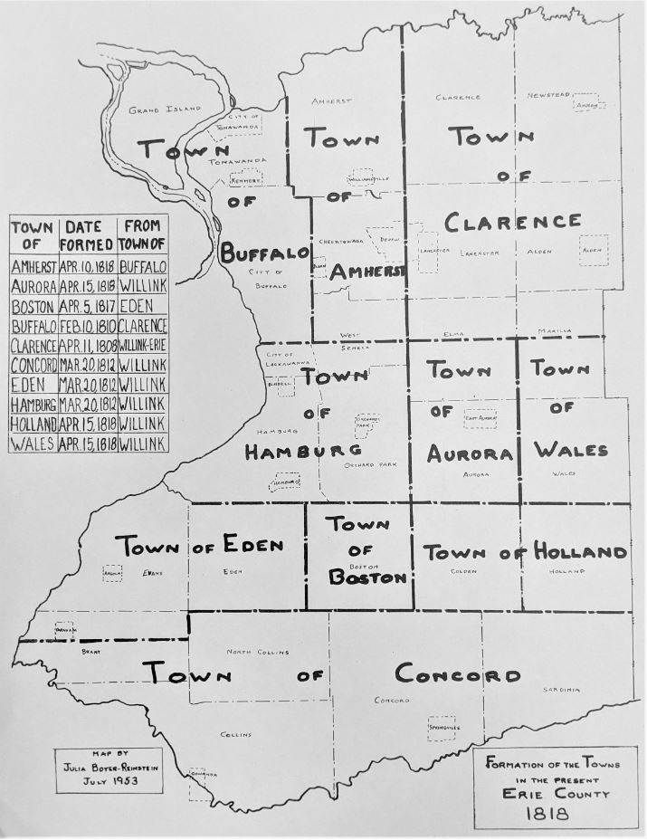
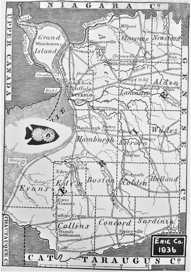
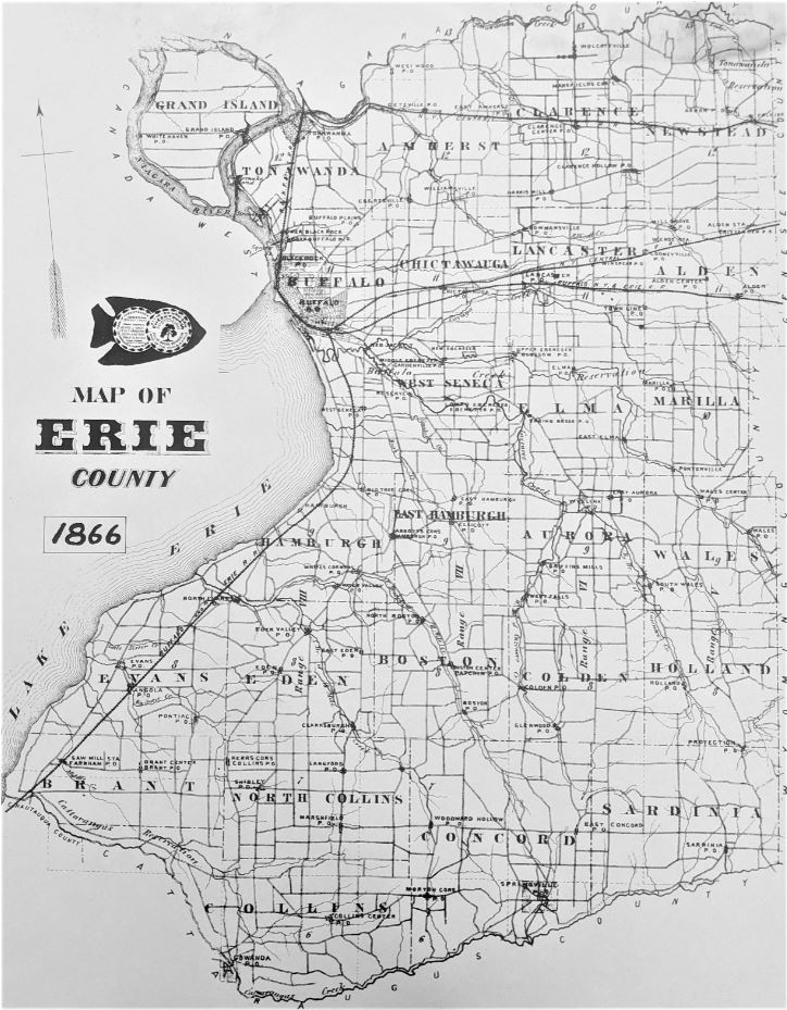
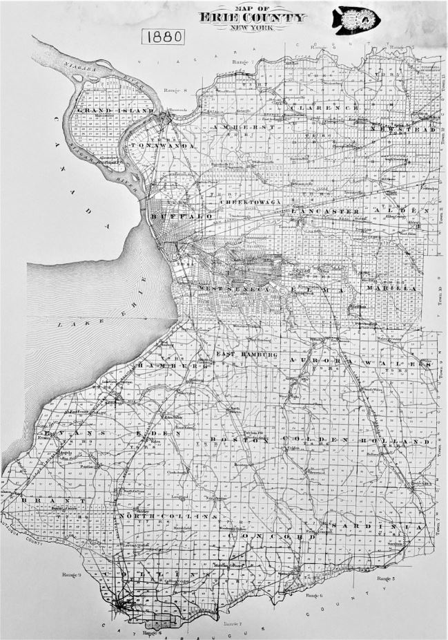
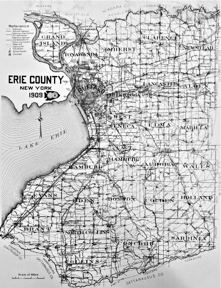
Gallery of Erie County Historical Maps