Environment & Planning
The Shoreline Trail is a continuous multi-use pathway along Lake Erie and the Niagara River, within Erie and Niagara counties. This page focuses on the Erie County sections.
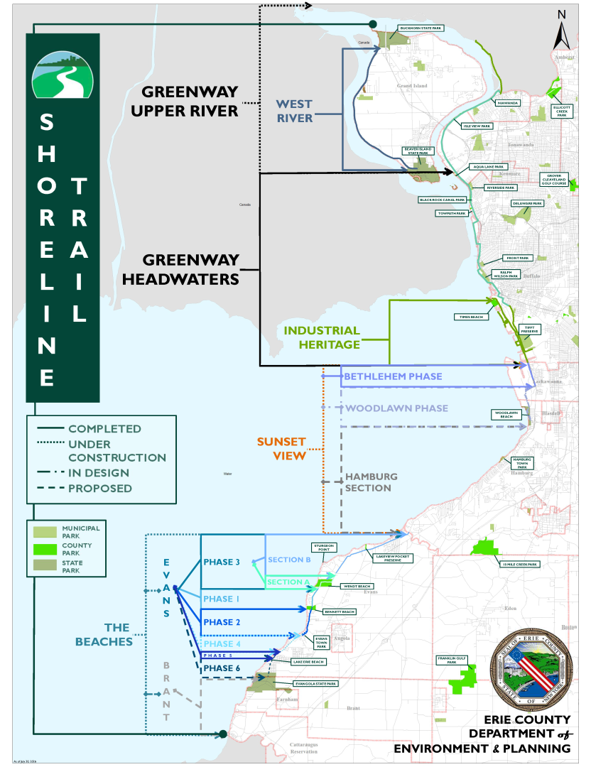
The trail has been constructed in sections, generally:
- West River - completed - from Buckhorn State Park to Beaver Island State Park on Grand Island (Note: the Niagara River Greenway Upper River area includes part of West River and the Riverwalk, from approximately Sheridan Drive to the county line/Erie Canal and Buckhorn State Park on Grand Island)
- Riverwalk - completed - from the West Terminus of the Erie Canal to Ohio Street at Michigan Avenue (Note: the Niagara River Greenway Headwaters area includes most of the Riverwalk, from the Buffalo/Lackawanna boundary to approximately Sheridan Drive)
- Industrial Heritage - completed - from the northern corner of Times Beach Nature Preserve to the Lackawanna city line
- Sunset View - in development - from the Buffalo/Lackawanna city line to Eighteen Mile Creek. This section includes the following subsections:
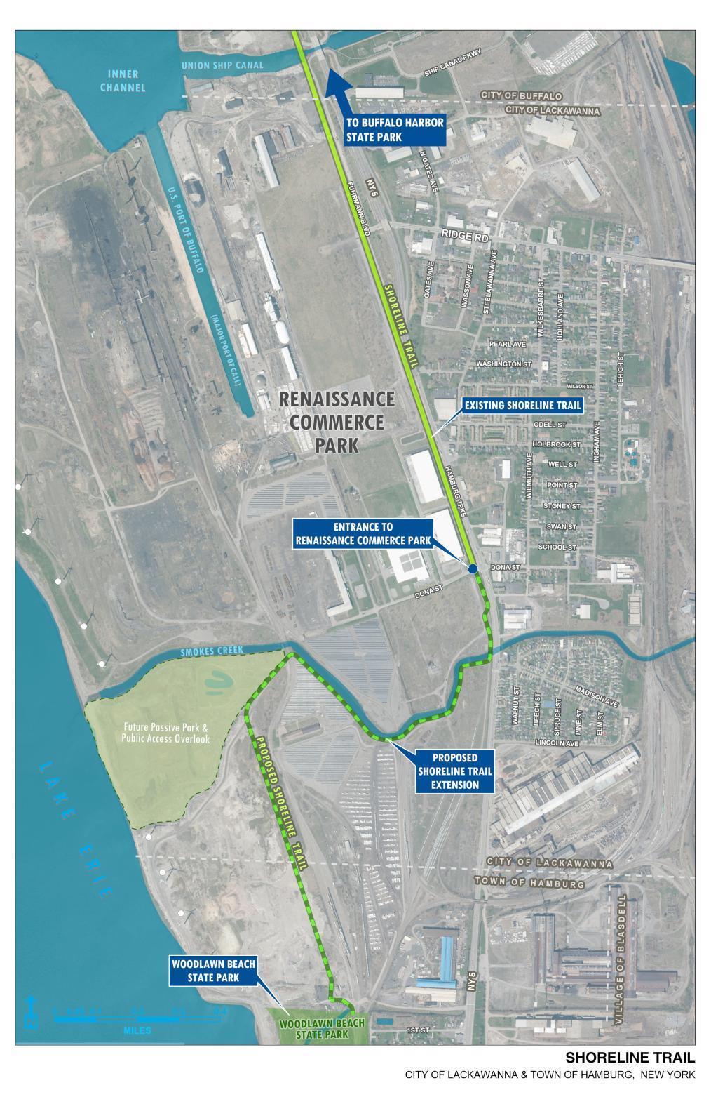
- Bethlehem Phase 1 - completed - from the Industrial Heritage section terminus to Dona Street/Renaissance Commerce Park in Lackawanna
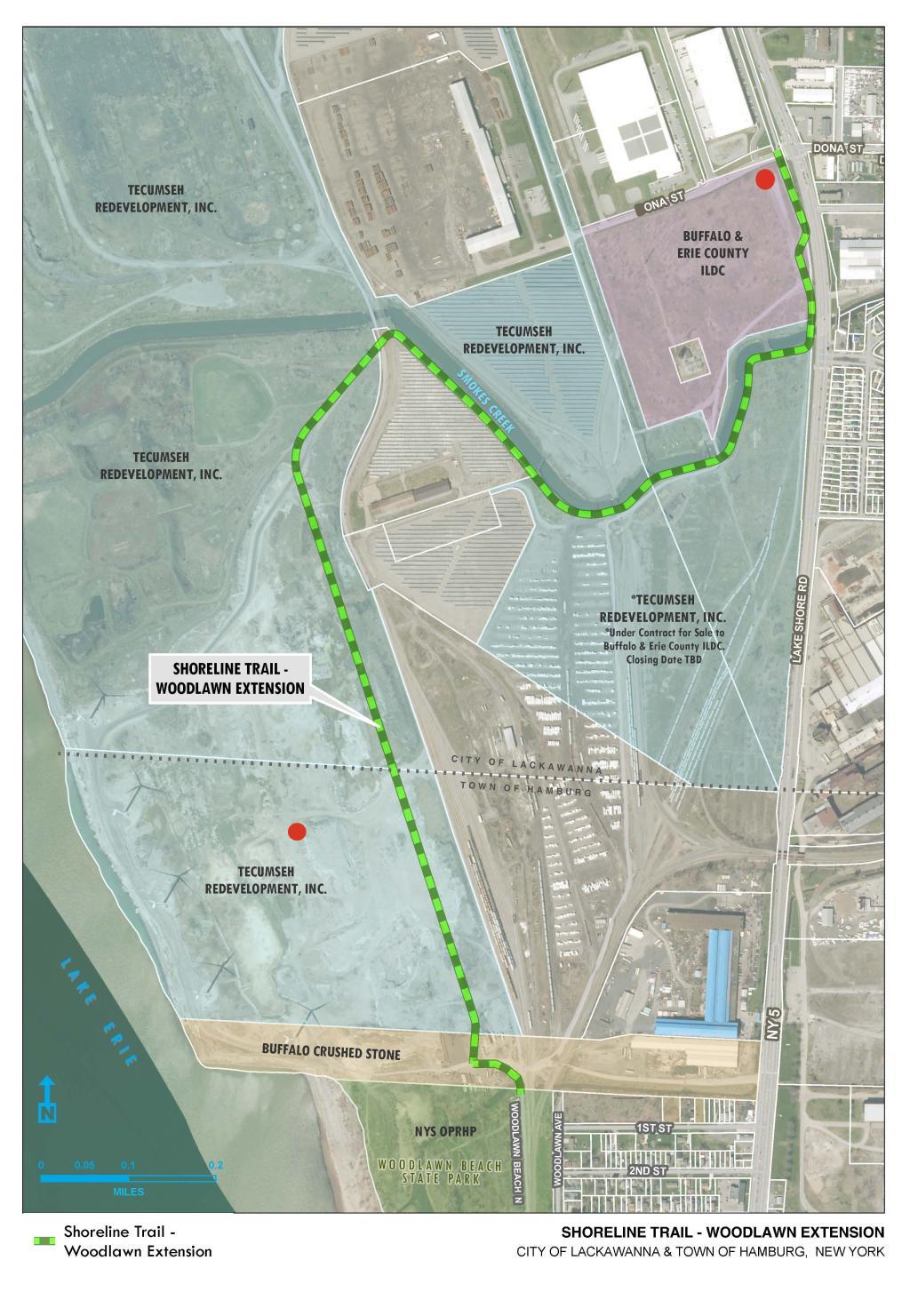
- Bethlehem Phase 2 - in design - from Dona Street to Woodlawn Beach
- Hamburg - proposed - from Woodlawn Beach to Eighteen Mile Creek
- Beaches - in development - from Eighteen Mile Creek to Cattaraugus Creek. This section includes the following subsections:
- Evans - in development - the Evans portion is divided into six phases (numbered in the original proposed development order)
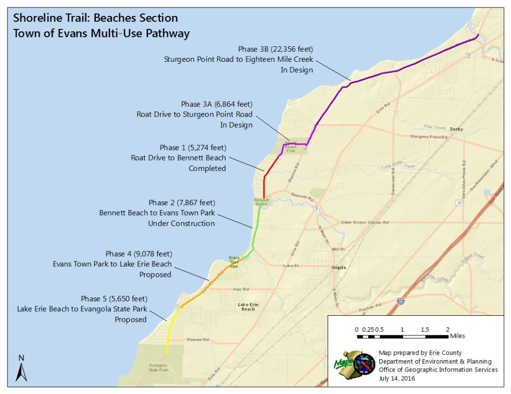
- Phase 1 - completed - from Wendt Beach to Bennett Beach
- Phase 2 - completed - from Bennett Beach to Evans Town Park. ON ROAD/enhanced shoulder and off road.
- Phase 3 - completed - from Eighteen Mile Creek to Wendt Beach
- Section A - completed - ON ROAD - from Eighteen Mile Creek to Sturgeon Point Road
- Section B - completed - from Sturgeon Point Road to Wendt Beach
- Phase 4 - proposed - from Evans Town Park to A J Schmidt Elementary School
- Phase 5 - completed - from A J Schmidt Elementary School to Lake Erie Beach
- Phase 6 - proposed - from Lake Erie Beach to Evangola State Park
- Brant - proposed - from Evangola State Park to Cattaraugus Creek
- Evans - in development - the Evans portion is divided into six phases (numbered in the original proposed development order)
This page includes more information for the in-development portions of the Shoreline Trail:
Completed sections of the Shoreline Trail:
- Riverwalk
- West River
- Outer Harbor/Industrial Heritage Trail
Connections to regional and state trails:
Documents
For the Signage and Standards Manual for the Shoreline Trail or the Niagara River Greenway please contact Mariely Ortiz at mariely.ortiz@erie.gov
The Beaches Section
- Town of Evans Sections
-
The Beaches sections of the Shoreline Trail consists of the construction of a multi-use pathway in the Town of Evans and Town of Brant. This is part of a larger effort to form a continuous multi-use pathway along Erie County's Lake Erie and Niagara River coast line.
This area of the County has a wealth of natural, recreational and scenic resources, predominantly running along Evans' 13-mile Lake Erie shoreline. Six public parks provide access to Lake Erie including Sturgeon Point Marina, Wendt Beach Park, Bennett Beach, Evans Town Park, Lake Erie Beach and Evangola State Park. Additional assets include Frank Lloyd Wright’s Graycliff Estate, and numerous scenic vistas.
The proposed Evans Multi-use Pathway seeks to connect and expand access to these assets through the introduction of an alternative transportation infrastructure. The pathway will predominantly follow Old Lake Shore Road, a National Scenic Byway and be part of Great Lakes Seaway Trail extending along New York State’s coast line of Lake Erie, Niagara River and Lake Ontario.
To guide this development a concept plan was developed in 2003. Although some details may have changed since the creation of the plan, the overall concept and goal is the same.
- Phase I - Completed
-
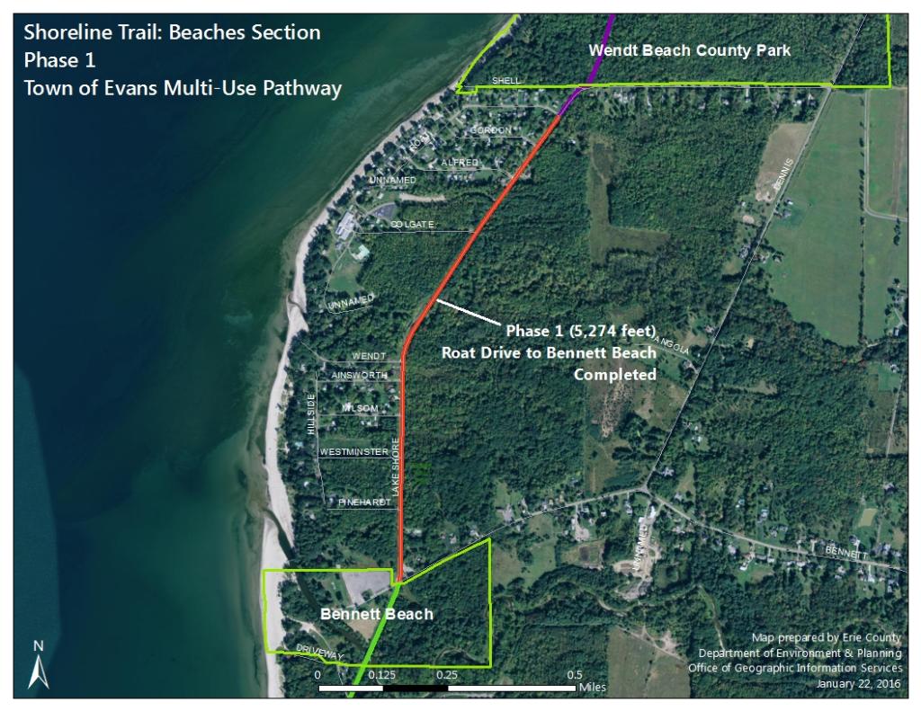
Phase 1 is an eight foot wide, off road multiuse pathway extending approximately 1.5 miles from the County’s Wendt Beach Park to Bennett Beach Park, starting at Roat Drive (just south of Wendt Beach Park) parallel to Old Lakeshore Road in the Town of Evans. The trail opened in 2014. It was funded with a combination of federal, state, and county dollars.
- Phase II - Completed
-
An 8 foot off road bicycle path will extend from Erie County’s Bennett Beach Park to the Evans Town Park parallel to Old Lakeshore Road in the Town of Evans. This is a distance of 1.5 miles. This section involves a combination of enhanced shoulder and shared lane. The pathway was funded through a combination of county and federal sources.
- Phase III - Completed
-
Section A - Completed
Section B - Completed
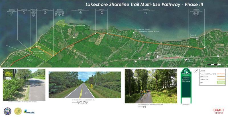
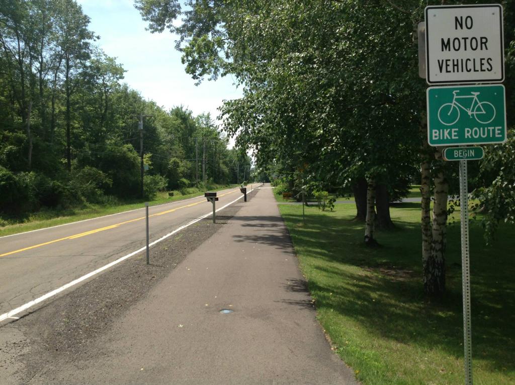
Phase 3 had to be divided into two sections. Section A is a dedicated bike lane on Lakeshore Road from Sturgeon Point Road, through Wendt Beach Park to Roat Drive just south of Wendt Beach Park; approximately 2 miles long. Section B is an on-road (shared lane) 4.2 mile route from Eighteen Mile Creek to Sturgeon Point Road.

Sunset View Section
- Bethlehem sections
-
For the past 40 years, the former Bethlehem Steel property has symbolized our region's heavy industrial decline and has been a blighting influence on the City of Lackawanna and the Buffalo Niagara region in general. This property also created a barrier for Lackawanna residents to access waterfront amenities.
- Phase 1 - completed
-
This section of the Shoreline trail will connect to the previously built Outer Harbor/Industrial Heritage Shoreline Trail, to enable safe access for Erie County residents and visitors to recreational amenities including Buffalo Harbor State Park, Gallagher Beach, Tifft Nature Preserve, and the Times Beach Preserve.
- Monday, October 29, 2018 - County Executive Mark Poloncarz Trail Open! post. Read the Press Release
- Tuesday, October 16, 2018 - County Executive Mark Poloncarz progress post
- Monday, August 20, 2018 - County Executive Mark Poloncarz progress post
- Wednesday, July 25, 2018 - County Executive Mark Poloncarz progress post
- Tuesday, July 24, 2018 - County Executive Mark Poloncarz progress post
- Monday, July 9, 2018 - County Executive Mark Poloncarz progress post
- Thursday, June 28,2018 - County Executive Mark Poloncarz progress post
- Thursday, May 31, 2018 - County Executive Mark Poloncarz breaking ground post
- Friday, February 9, 2018 - Phase 1 to bid
- Tuesday, July 25, 2017 - Erie County acquires 148 acres of the industrial site for redevelopment. Click here for specifics of the site
- Thursday, July 14, 2016 - Public Information Meeting from 4:30pm to 7:00pm, City of Lackawanna Council Chambers, 714 Ridge Rd, Lackawanna, NY (PDF Notice).
- Phase 2 - in design
-
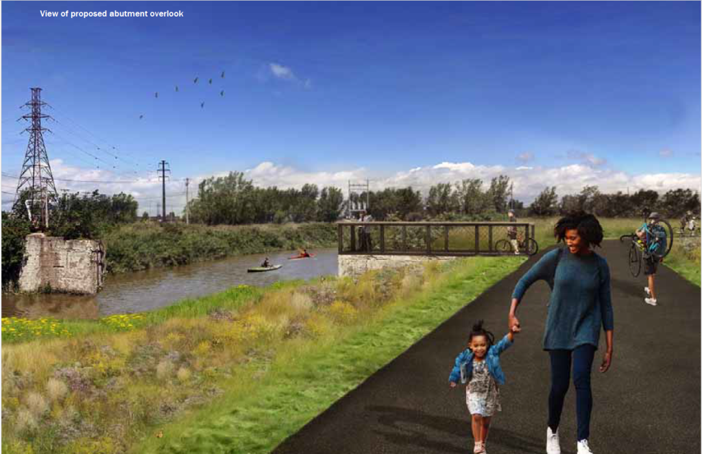
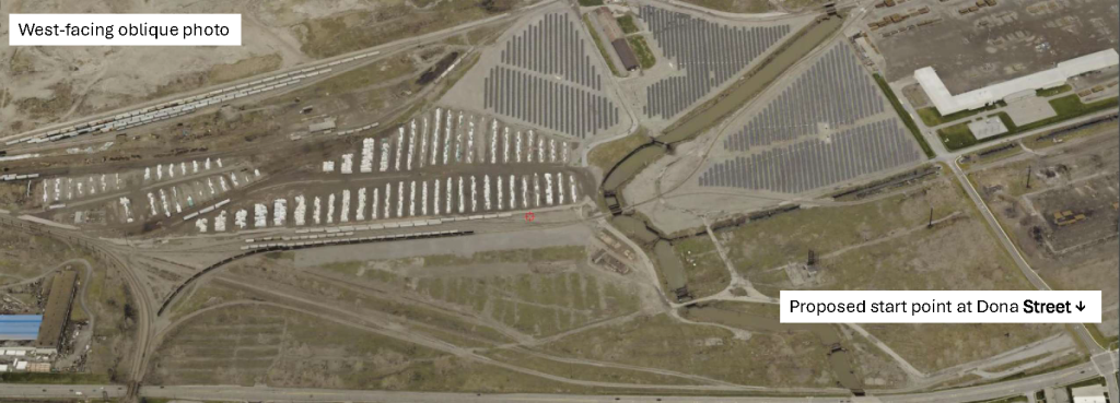
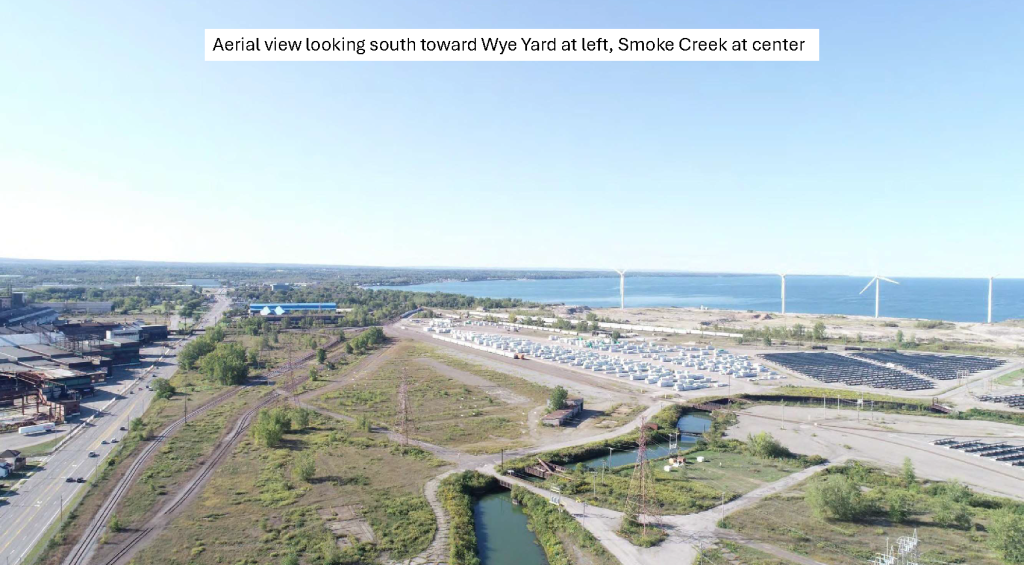
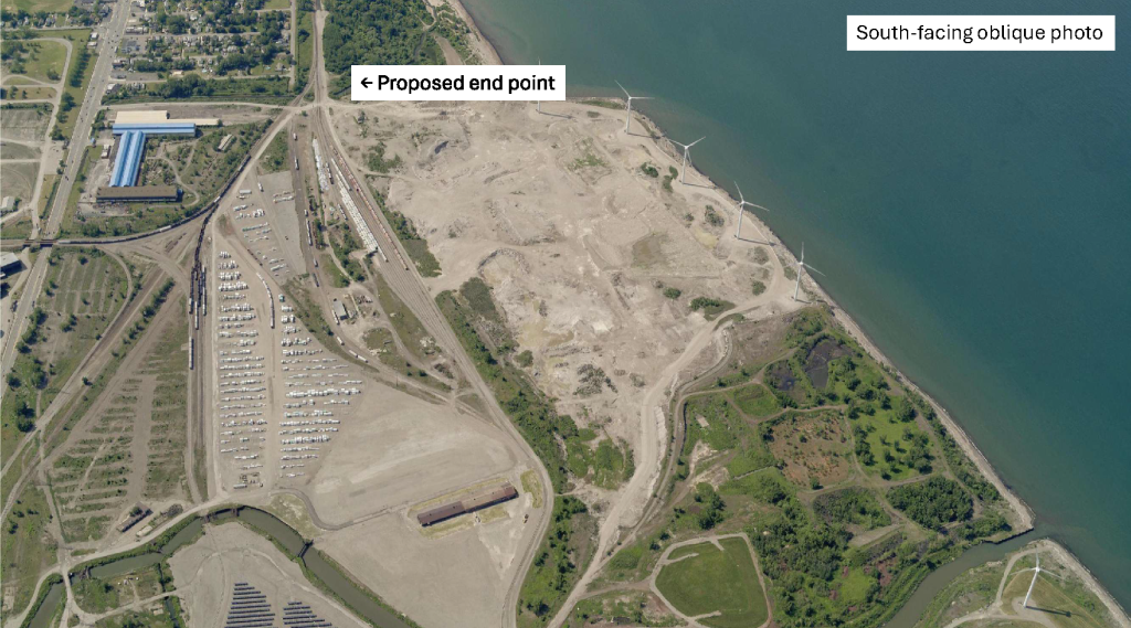
The trail follows Section 1 of the community-preferred Alternative 3 alignment from the 2021 Woodlawn Beach Shoreline Trail Master Plan. Starting at the trail's current terminus at Dona Street in the City of Lackawanna (Renaissance Commerce Park), the route proceeds south across an abandoned railroad bridge over Smoke Creek, then turns west along the creek's southern shore. After safely navigating across two at-grade rail lines via gated crossings, the trail turns south to run parallel to the active rail corridor. This segment will be elevated on a 10- to 15-foot berm to maximize views of Lake Erie while physically separating users from the adjacent industrial and rail activities. Continuing south, the trail will return to at-grade as it turns slightly east entering Woodlawn Beach State Park at the Woodlawn Beach North roadway.